Brought to you by Scott P. Rogers, Funkhouser Real Estate Group, 540-578-0102, scott@HarrisonburgHousingToday.com
Brought to you by Scott P. Rogers, Funkhouser Real Estate Group, 540-578-0102, scott@HarrisonburgHousingToday.com
Wednesday, December 6, 2017

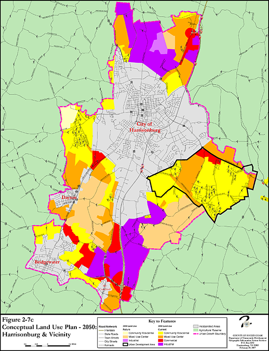
Just as there is a land use guide for the City of Harrisonburg, there is also a Conceptual Land Use Plan for many areas of Rockingham County. Above, I have included the Conceptual Land Use Plan for the areas just outside Harrisonburg (but in Rockingham County) for the year 2050.
You can find many more maps -- showing different time frames, and different areas of the County -- on the County's comprehensive plan website.
Of note, as you glance at the map above (or this PDF) you might note that the bright yellow regions are intended to be developed for residential use. It is not surprising that the largest contiguous section of such land is just East of the City, in what is referred to as the Urban Development Area.
Industrial uses seem to largely be focused just North of the City and just South of the City.
Enjoy exploring many more maps here.
