Brought to you by Scott P. Rogers, Funkhouser Real Estate Group, 540-578-0102, scott@HarrisonburgHousingToday.com
Brought to you by Scott P. Rogers, Funkhouser Real Estate Group, 540-578-0102, scott@HarrisonburgHousingToday.com
Thursday, September 17, 2020

The Rockingham County GIS (geographic information system) is run by InteractiveGIS and they pointed out a fun feature to me recently...
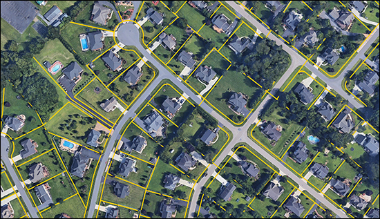
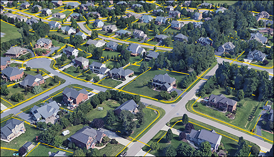
In a nutshell, you can select a bunch of parcels (properties) in the GIS and export those property lines from the GIS and then import them to Google Earth!
The image above is the result of this export and import process.
Now, you might note that the GIS already allows you to see an overlay of property lines on top of an aerial image -- but moving the property lines over to Google Earth allows you to have a 3D view with property lines -- and to interact with it, zooming and panning, and doing all the fun things you can do in Google Earth...

Here's how to do this, in a nutshell...
Rockingham County GIS
- Search
- Proximity Search
- Draw Polygon
- Search
- Export Results to KML
Google Earth
- Projects
- Open, Import KML file from computer
Give it a try and let me know if you need help making use of this cool functionality in our local (Rockingham County) GIS.
