| Newer Posts | Older Posts |
Do you now live in Rockingham, VA? |
|
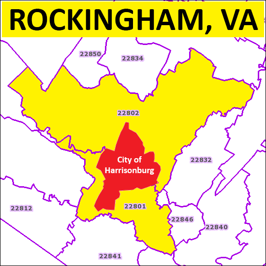 If your zip code is 22801 or 22801, and you live in Rockingham County (shown in yellow above) then your mailing address can be written in two different ways starting in February 2015....either as "Harrisonburg, VA 22801" or "Rockingham, VA 22801", and it's all about taxes.... From today's Daily News Record article.... Starting in February, the U.S. Postal Service will begin updating its database so the two ZIP codes will have a default mailing address of Harrisonburg, VA, and an "alternate preferred" address of Rockingham, VA.Read the rest of the article here. | |
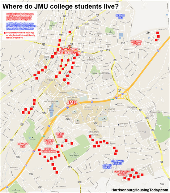
Where do JMU college students live in Harrisonburg? |
|
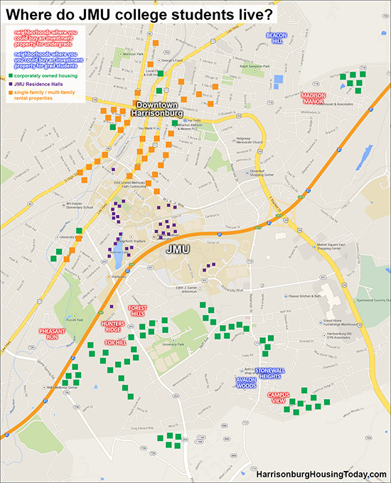 click here for a larger version of the map or here for a PDF Enjoy this updated map showing where JMU college students live, in a few categories of housing....
If you are interested in purchasing an investment property in Harrisonburg -- for college students, or not -- feel free to drop me an email (scott@HarrisonburgHousingToday.com) and we can discuss the best opportunities for you. | |
History of the Street Names in Highland Park Subdivision |
|
 What do these street names have in common? What is their connection?
They were all names of General Robert E. Lee's horses! A bit more of the story can be found here....
Search for homes in Highland Park here. Thanks for the heads up, Mary Kaye! | |
Go back in time with Google Street View |
|
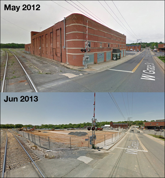 You can now go back in time with Google Street View, exploring how Harrisonburg's streetscape has changed over the years. Above, you will note the changes on Grace Street. 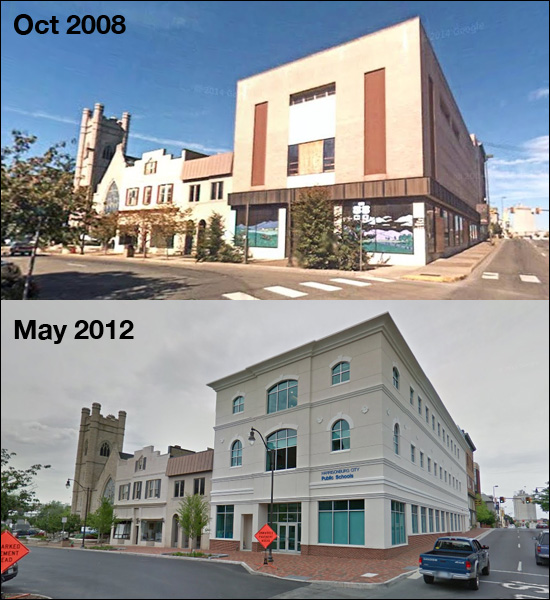 Court Square also has a new look, with the transformation of 1 Court Square into the offices for Harrisonburg City Public Schools. The historical Street View data goes back as far as 2008 for some areas in Harrisonburg. 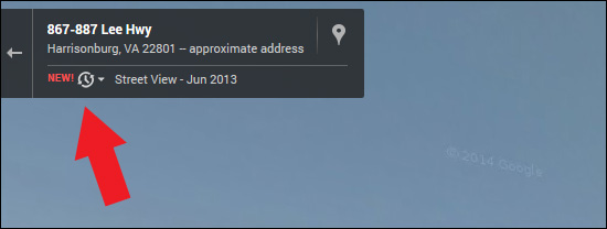 How do you explore this fun historical drive through Harrisonburg? When you are in Google Street View, just click on the clock icon shown above to select a different time frame. | |
New Geographic Information System (GIS) for Rockingham County |
|
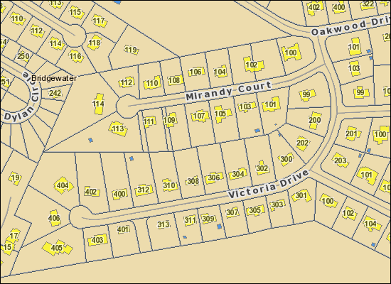 A new GIS service is available for Rockingham County -- bookmark it now -- http://rockingham.interactivegis.com. Per Rockingham County.... The increase in performance and stability along with new functionality will enhance user ability to interact and navigate inside the County map, obtaining data related to specific interests at a more efficient rate.I have explored a bit, and it does seem to be an improvement over the old GIS, and it even has a mobile site! Rockingham County GIS | |
Harrisonburg in 3D via Google Maps |
|
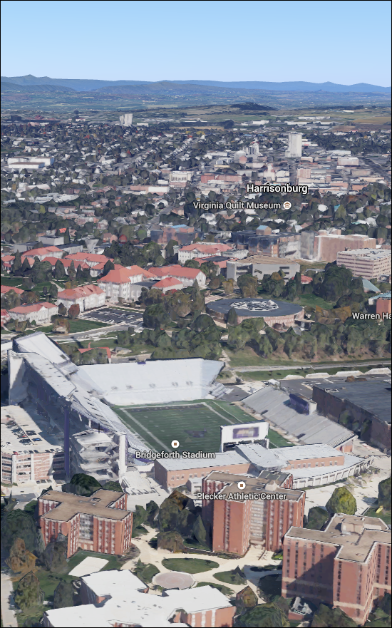 A big thanks to Hamilton for pointing out that the new version of Google Maps now allows you to explore Harrisonburg in 3D....zooming, tilting, panning, and more. When you go to Google Maps on your browser make sure you are using the new Google Maps, it will probably let you know if you are using the old one. You might need a Gmail or Google Account to use it right now. Once you are on the new Google Maps click on the aerial view in the bottom left corner, called Earth view in the new Google Maps. Then zoom in over Harrisonburg and click on the tilt view button in the bottom right corner above the zoom buttons. The 3D mode uses more data so it can run slowly, but it offers a very intriguing way to explore Harrisonburg. | |
Map of Harrisonburg, VA |
|
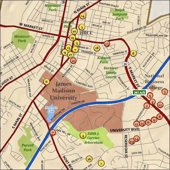 Here is a helpful map of Harrisonburg produced by Harrisonburg Tourism. There are two pages / sides to this map. Download the PDF here. | |
The Bridges of Rockingham County |
|
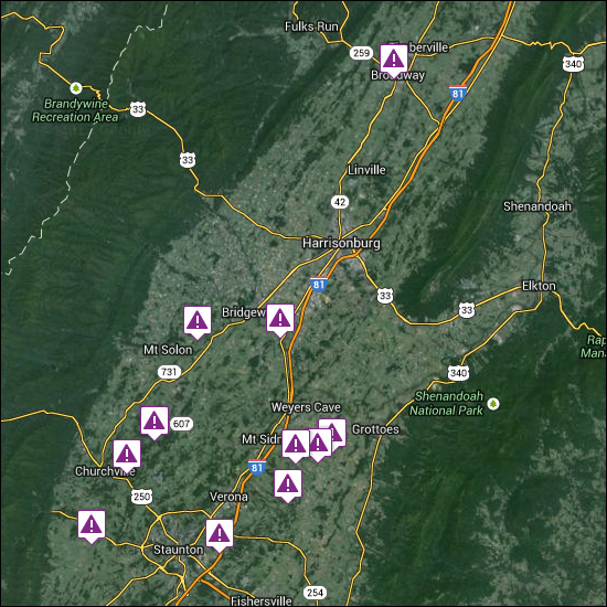 Explore SaveOurBridges.com to see how many unsafe bridges are in your area. This web site uses Google Maps and data from the Federal Highway Administration's National Bridge Inventory to show where all the country's "structurally deficient" and "fracture critical" bridges are located. From the data on this web site, Augusta County has quite a few more unsafe bridges than we have here in Rockingham County. | |
Cell Coverage in Harrisonburg, Rockingham County |
|
Thanks to Jim Duncan for pointing out OpenSignal as a resource for checking cell coverage.... 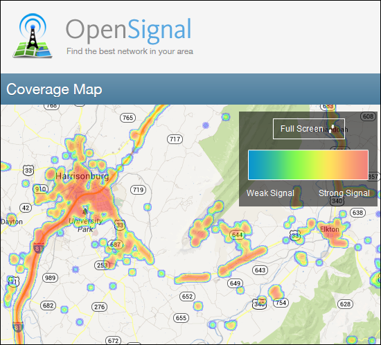 The heat map above shows the strength of cell coverage in Harrisonburg and Rockingham County. The map as shown shouldn't be too surprising, as it mirrors main roadways and dense residential areas. Here's how the cell carriers stack up in this area, with Verizon Wireless being the clear winner.... 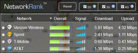 | |
Cool Aerials from Google Maps: JMU University Park |
|
You may have driven by this new complex (corner of Port Republic Road and Neff Avenue) but have you seen the full scope of it? 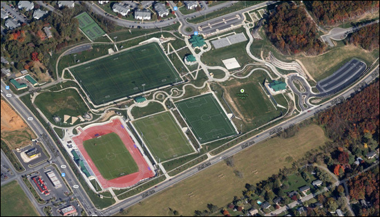 I had driven by University Park countless times, but until my son participated in a soccer camp earlier this month with Shenandaoh Valley United, I had never seen the facility in person. This is an amazing multi-field complex, offering both grass and FieldTurf practice field as well as a finely-manicured game-playing surface of natural grass. JMU Women's Lacrosse, Women's Soccer, Men's Soccer and Women's Cross Country/Track & Field programs compete at this location. Click here for a map of the complex. | |
I am enjoying this new perspective on Google Maps |
|
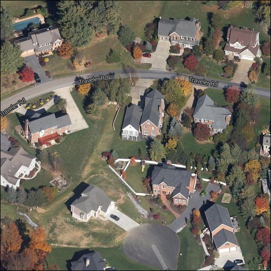 Google Maps now offers imagery of the Harrisonburg area from a 45 degree perspective, as shown above. Compare the image above (45 degree perspective) to the same area below (aerial view).... 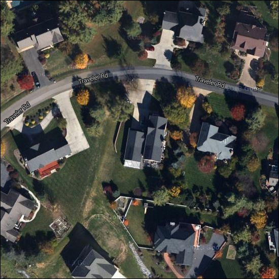 As you can see, this 45 degree perspective provides a much more interesting view. To view this imagery, just keep zooming in on a Google Map until you get to a zoom level where Google automatically flips you over to the 45 degree perspective instead of the aerial perspective. You can also adjust this setting in the upper right corner of the map.... 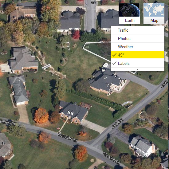 | |
Cool Aerials from Google Maps: Quarry near Smithland Elementary |
|
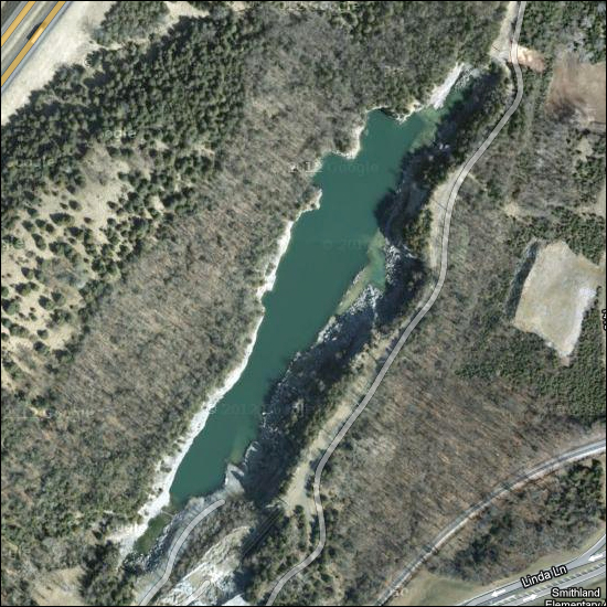 Hidden just out of site between Linda Lane and Interstate 81, there is a huge quarry -- possibly the site of a future 160-Acre Mixed Use Development. Previous Cool Aerials from Google Maps: | |
Cool Aerials from Google Maps: Frazier Quarry |
|
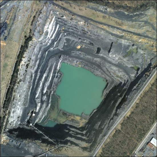 You might have driven by Frazier Quarry on Waterman Drive and not even noticed this enormous quarry located within the Harrisonburg City Limits! You'll see a lot of the stone from Frazier Quarry located on the bluestone buildings at JMU. Learn more about bluestone, Frazier Quarry and JMU here. | |
Rockingham is Virginia's 20th Healthiest County (of 131) |
|
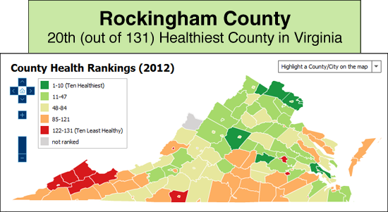 Rockingham County is ranked 20th in Virginia in County Health Rankings as of 2012. Explore more interactive maps at the Weldon Cooper Center.for Public Service. | |
Google Street View GREATLY expanded in Harrisonburg |
|
Almost four years ago, I mentioned that you could drive virtually through most of Harrisonburg using Google Street View, with the big disclaimer that the data was relatively limited. No longer. 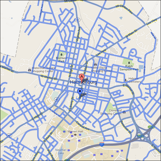 The blue lines above show all of the streets where the Google Street View car has driven to capture imagery. And the imagery is a LOT clearer! This is East Market Street in 2009.... 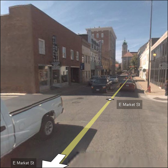 And this is the same general area in 2013.... 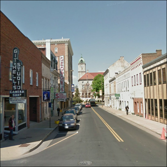 This is certainly a wonderful way to explore the streets and neighborhoods of Harrisonburg! To access Google Street View, just click on the imagery to the left of a Google Map (circled in red below) or drag the yellow Google Street View man onto the map (circled in red below). 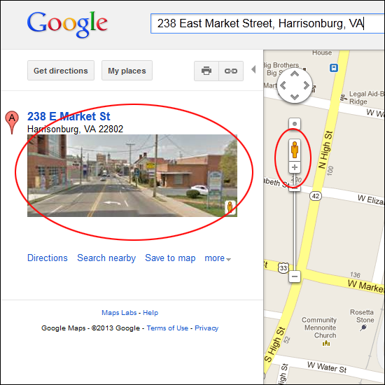 | |
New hospital, road infrasture lead to new developments along Port Republic Road |
|
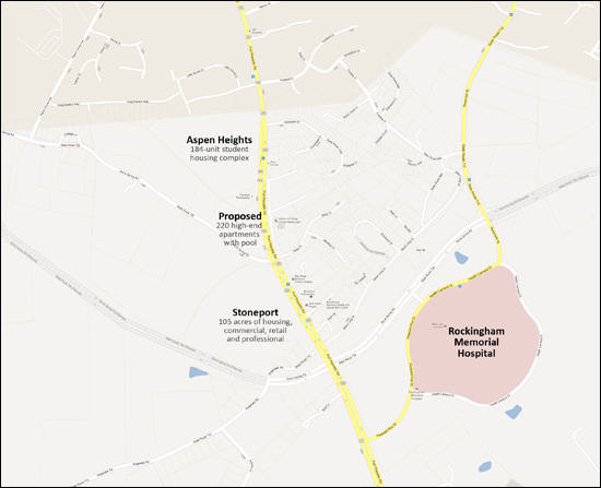 Click on the map above to view a larger version. In the past several years we have seen quite a few changes on Port Republic Road on the map shown above, including:
All of this new road infrastructure, plus the new hospital, plus a clustering of residential developments over the past 15-20 years has lead to quite a few new projects labeled on the map above.
Given the new hospital, the new road infrastructure, and the large area of existing housing, it is not surprise that we are seeing these new developments along Port Republic Road. Stoneport is the largest of the new projects, and it will certainly be interesting to see what businesses are established in that location. | |
Map of Hunters Ridge Condos and Townhouses in Harrisonburg, VA |
|
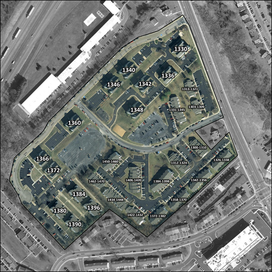 Out of town investors often wonder where a particular property is located at Hunters Ridge --- now they need wonder no longer. Click the map above for a printable version (4.8M) of this map of Hunters Ridge. I have labeled each condo building and group of townhouses by its address. View properties for sale in: Hunters Ridge Condos, Hunters Ridge Townhouses | |
Where do JMU college students live in Harrisonburg? |
|
Thanks Google! View new location of Stone Spring Road, plus County property lines! |
|
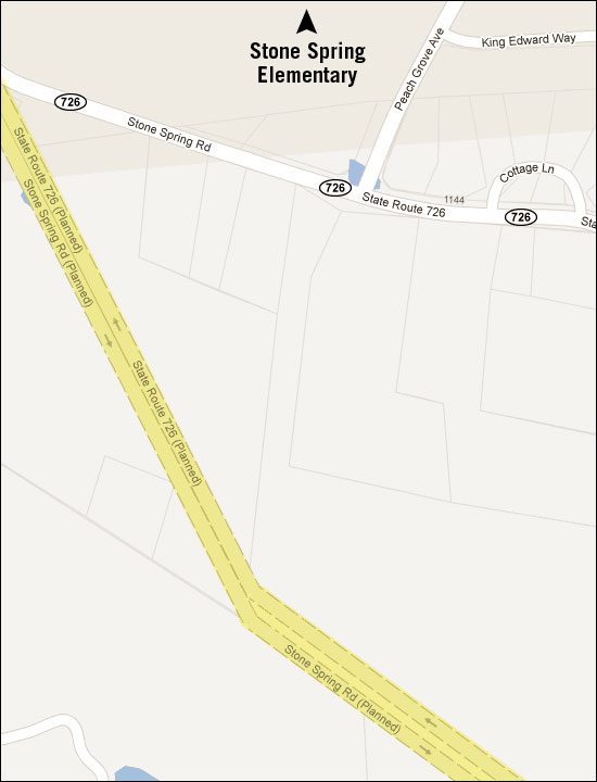 If you zoom in far enough on Google Maps, you'll see the planned location of the Stone Spring Road. Also of interest, you can now view County property lines in Google Maps. 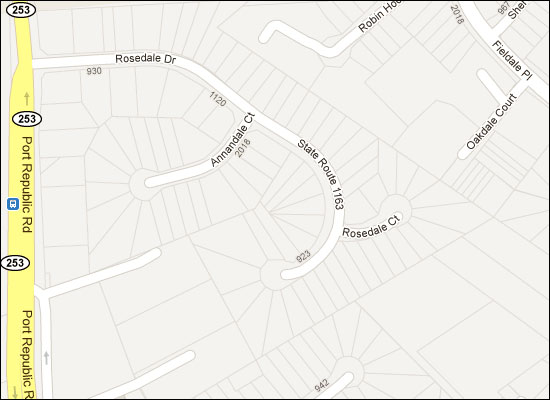 | |
The unspoken East-West Divide of Greater Harrisonburg |
|
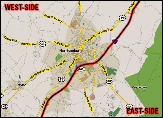 I don't know if Interstate 81 is really the dividing line, or if there actually is a dividing line -- but I have found that many (most?) home buyers are strongly oriented to one side of Harrisonburg or the other. EAST: Most of the residential development over the past ten to fifteen years has been on the East side of Harrisonburg, in the general vicinity of the new hospital. This makes it an exciting place to live -- for some people. There are many newer developments where homes have recently been built, and there are newer commercial destinations (Martin's grocery store, Target, etc) all on the East side of town. But this also makes it a bit more hectic for getting around. Of note, there is also plenty of outbound traffic East of town, towards Massanutten, Elkton, Charlottesville, etc. WEST: There hasn't been as much residential development West of Harrisonburg over the past ten to fifteen years (other than Belmont and Monte Vista Estates) and this is just fine with most people who live on the Western side of Harrisonburg. Things are a bit calmer, without as much hustle and bustle, and in some cases with more established neighborhoods. The towns of Dayton and Bridgewater end up falling into this side of town as well for many people. I am not doing justice to all of the differences between the East side of town and the West side of town, but I believe that most people in this area are oriented towards one side of town or the other, for very specific reasons. Furthermore, most people who have spent any considerable amount of time living on one side of Harrisonburg likely wouldn't think about moving over to the other side of Harrisonburg. | |
| Newer Posts | Older Posts |
Scott Rogers
Funkhouser Real
Estate Group
540-578-0102
scott@funkhousergroup.com
Licensed in the
Commonwealth of Virginia
Home Search
Housing Market Report
Harrisonburg Townhouses
Walk Through This Home
Investment Properties
Harrisonburg Foreclosures
Property Transfers
New Listings

